Water Networks
Array
999,00 €
Product Info
Version 22 - September 2023

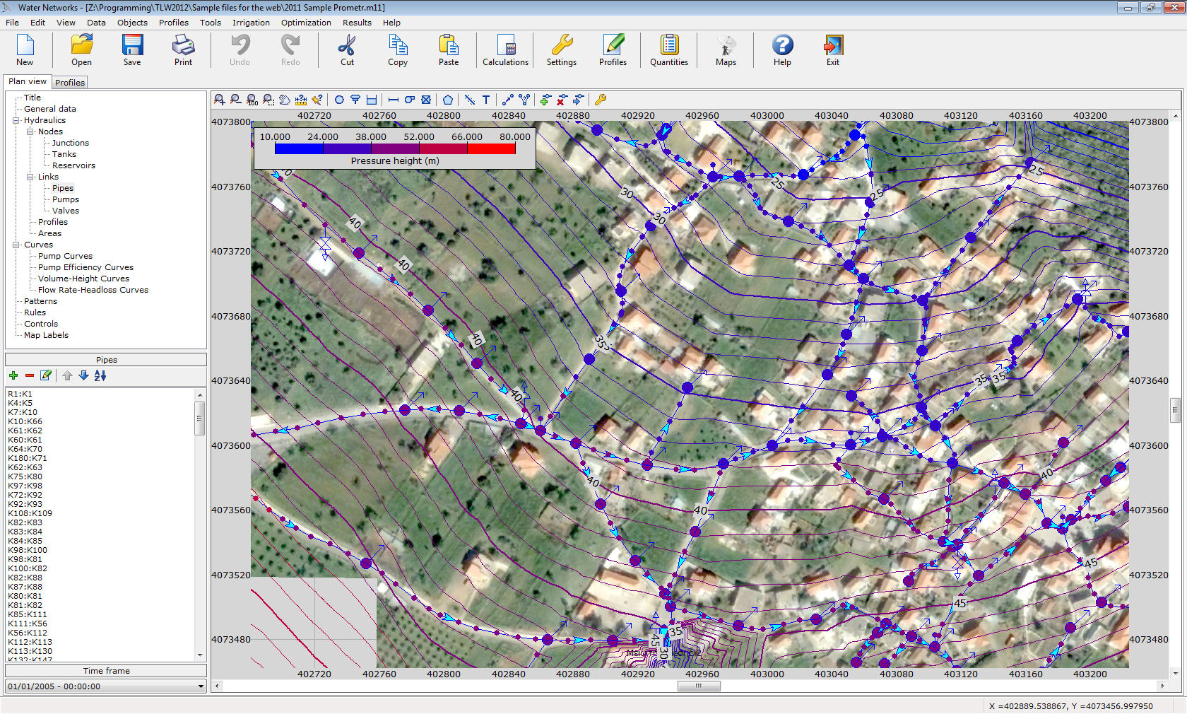
This program solves water and irrigation networks, i.e. networks under pressure. The energy losses along the pipes are calculated based on one of the following friction formulas: Manning, Darcy-Weisbach or Hazen-Williams. Apart from hydraulic analysis, water quality analysis can also be performed. The program can be used for single or extended period analyses. The network may contain any number of objects, i.e. nodes, pipes, tanks, reservoirs, valves, hydrants, pumps, air release valves and vacuum valves. The profile drawings can be created with one click.
What’s new
Features
- Solves water networks.
- Solves irrigation networks.
- Solves aquaducts.
- Steady or time-varying solutions.
- Quality solver:
- Trace
- Age of water in pipes
- Chemicals.
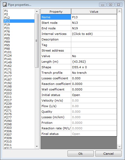
- Unlimited number of nodes:
- junctions
- vertices
- air valves
- vacuum valves.
- Unlimited number of links:
- pipes
- valves
- pumps.
- CAD-like user interface comes with add, delete, move, stretch and lots of other useful functions.
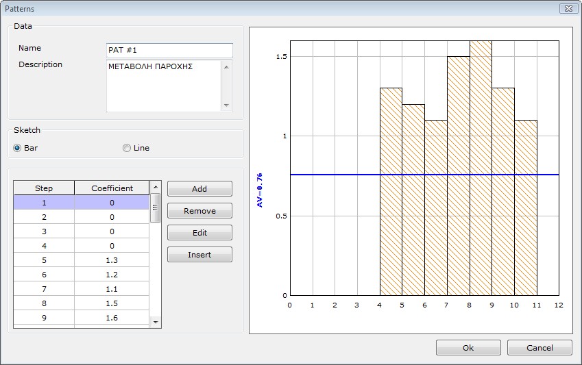
- Unlimited time varying curves, controls and composite rules.
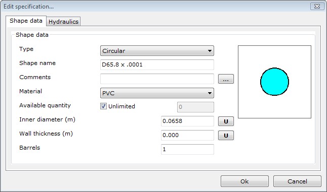
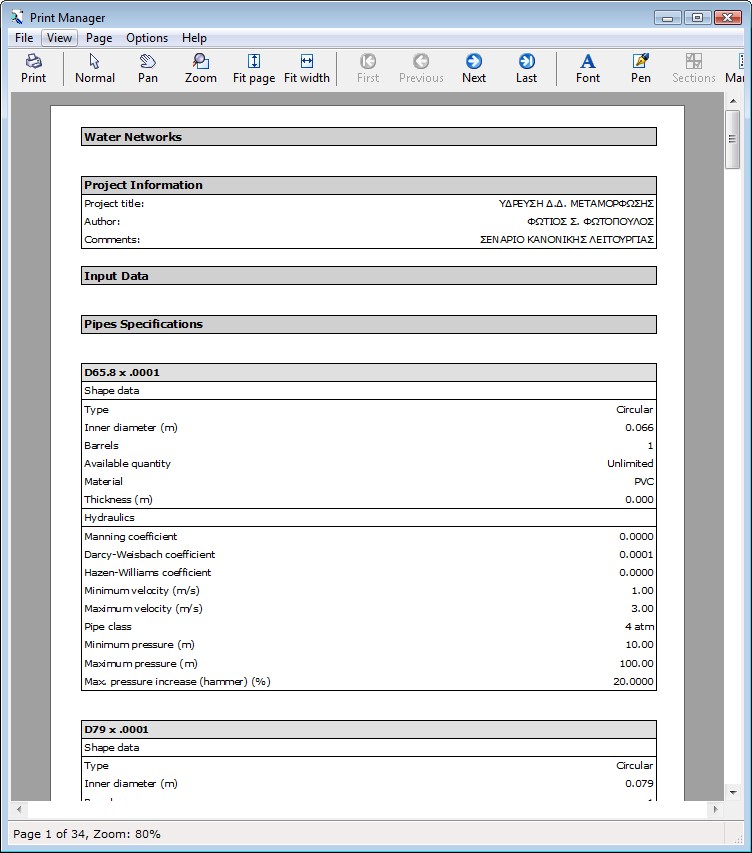
- Supported friction formulas to calculate linear energy losses through the network elements:
- Manning
- Darcy-Weisbach
- Hazen-Williams.
- Calibration functions facilitate checking of existing networks.
- Capability of creating a background collage of satellite images. The images are inserted through a special window in any resolution desired. The images are modified automatically (with translation, rotation, skewness) to fit a certain coordinate system. The overlap is precise and the boundary of the images is practically invisible. This allows the full coverage of the area of the project and diminishes the posibility of error. This capability requires an Internet connection. Also, the quality of the sattelite images varies.
- Import background from DXF.
- Import/export from/to DXF/GIS/GPS/EPANET/LandXML.
- Import/export data from/to Microsoft Excel or other spreadsheets.
- Databases:
- friction coefficients
- water consumptions
- materials.
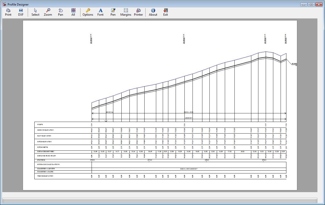
- Automatically plot selected profiles and export them to DXF
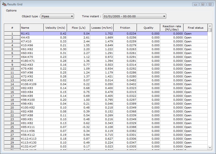
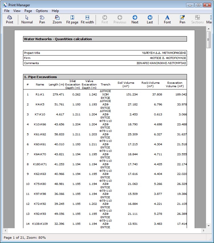
- Tabulated results.
- Graphical representation of selected output variables.
- Animated results.
- Full compatibility with previous versions of the program.
- Multiple level undo and redo.
- Professional reports and printouts.
- Many tools and automations.
- Formatted output to Microsoft Word for professional printouts with minimal user intervention.
- Improved DXF output with free object labeling.
- Different colors per pipe specification.
- A valve can be set in either the upstream or downstream end of a conduit.
- Object coloring based in their properties or results. The objects can be categorized in up to 255 classes.
- Dynamic change of symbol sizes based on zoom factor.
- Tip of the day.
- Axis elevation can either be set to a constant depth or be calculated based on linear interpolation between known elevations.
- Αutomatic renaming of profile nodes.
- Evaluation of ground elevation based on satellite data.
- Improved filters for the results.
- SNAP functionality on background objects.
- Optionally it may be combined with the water networks toolpack.
- Full user guide.
- Tutorials.
- Live Update.
- English and Greek interface