") English (UK)
English (UK)") Greek (Greece)
Greek (Greece) 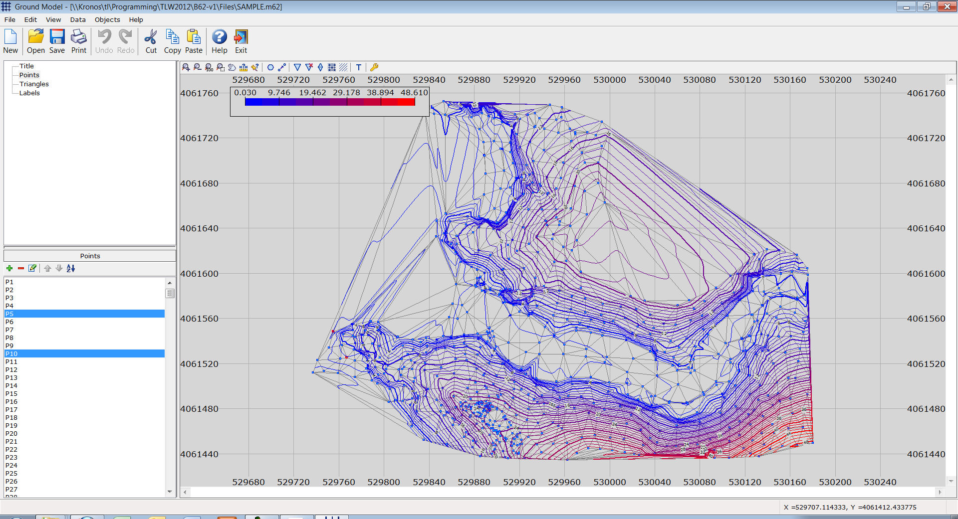
Ground Model
Array
99,00 €
Product Info
Version 15
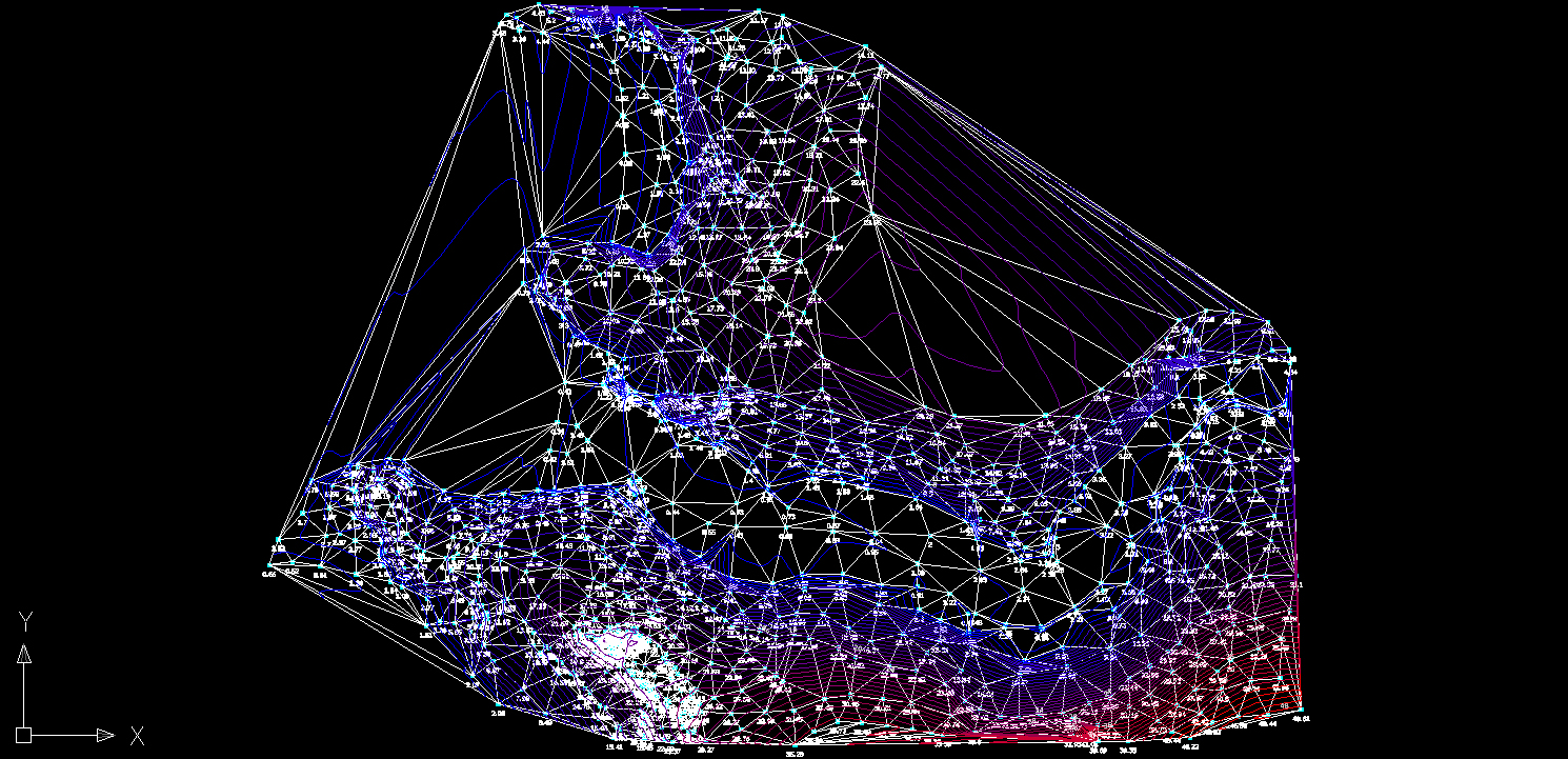
This program is a generic tool for creating a ground model based on point data. Usually, the data are the elevations of the points. The program creates a TIN (Triangulated Irregular Network) and the corresponding contours. The results can be exported in DXF files.
Features
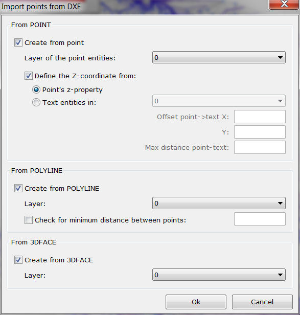
- Easy data input from DXF files using POINTS (and, optionally, reading the elevation from TEXT entities), POLYLINES (with automatic control of point density) and/or 3DFACES.
- Calculation of point elevations using Google API (requires a free Google API key).
- Creation of TIN.
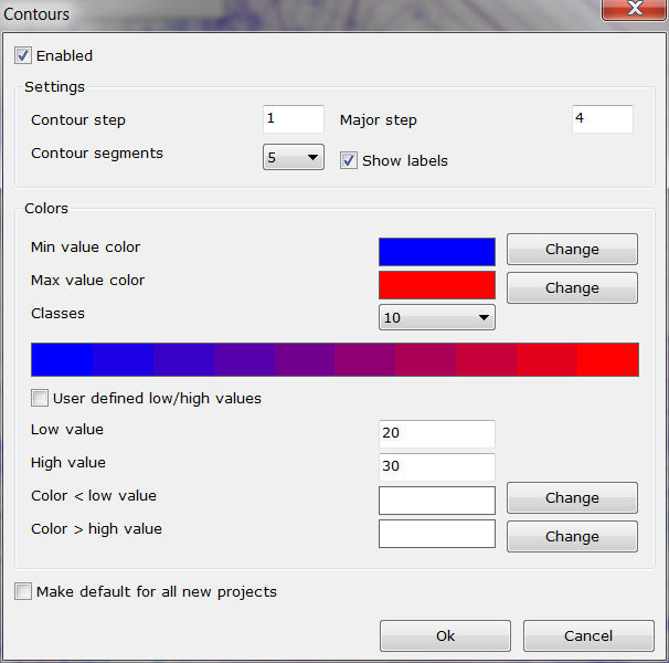
- Creation of colored major/minor contours.
- Export to a DXF file.
- Tip of the day.
- User guide.
- Live Update.
- Greek and English interface.