") English (UK)
English (UK)") Greek (Greece)
Greek (Greece) 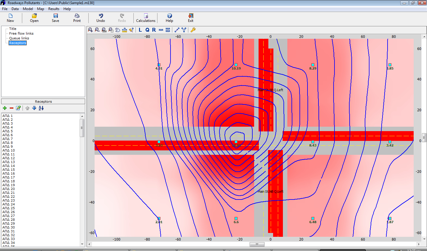
Roadway Pollutants
Array
399,00 €
Product Info
Version 19
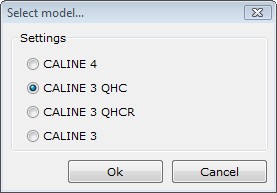
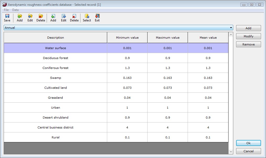
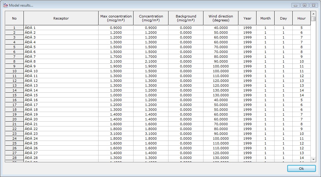
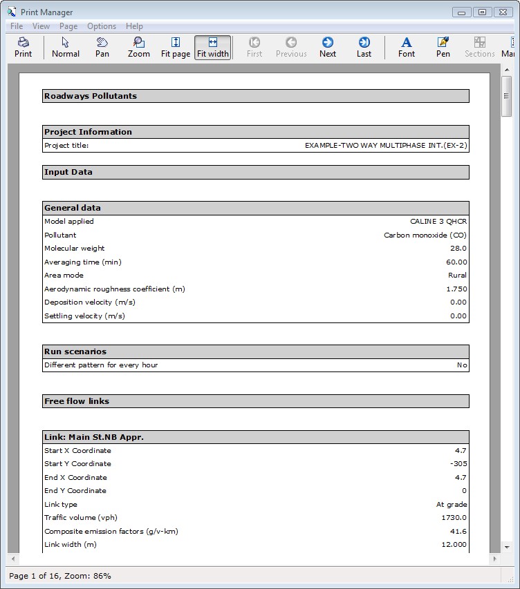
This program implements a dispersion model for predicting air pollutant concentrations near roadways, taking into account various meteorological and topological data as well as air pollutant and vehicle characteristics. The program can handle any number or combination of links, queues and receptors. A receptor is a point where the air pollutant concentration is calculated. The calculations are based on one of the following well-known EPA Gaussian models of air pollutant dispersion: Caline 3 QHCR, Caline 3 QHC, Caline 3 and Caline 4. You can select one of these models and perform the calculations. The results are displayed analytically or graphically (by a pollution contour) or both.
Features
- Prediction of air pollutant concentrations near roadways using one of the following models:
- Caline 3 QHCR
- Caline 3 QHC
- Caline 3
- Caline 4
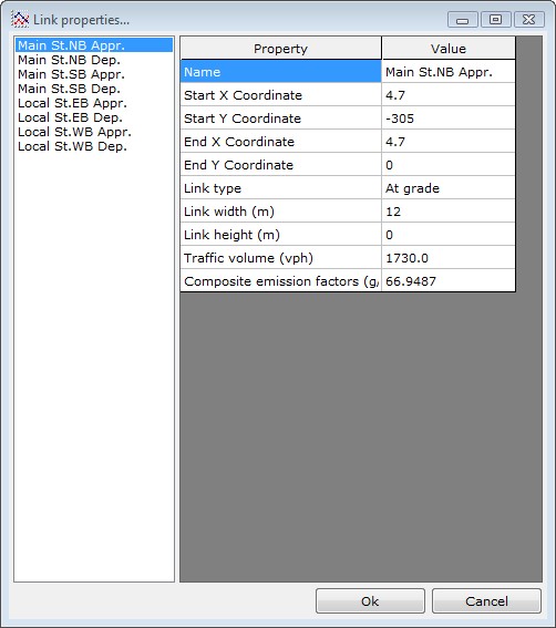
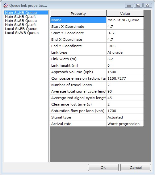
- Handles unlimited number of objects:
- links
- queue links
- receptors
- scenarios
- Multi editing, i.e. change a property of many links simultaneously.
- Capability of creating a background collage of satellite images. The images are inserted through a special window in any resolution desired. The images are modified automatically (with translation, rotation, skewness) to fit a certain coordinate system. The overlap is precise and the boundary of the images is practically invisible. This allows the full coverage of the area of the project and diminishes the posibility of error. This capability requires an Internet connection. Also, the quality of the sattelite images varies.
- Due to the previous update, the format of the DXF output file is now DXF2000, in order to accomodate the additional elements.
- Gradient coloring has been added to the contours, which is exported in the DXF.
- Unique user interface where you can add, move or delete existing objects analytically or graphically.
- Use background maps, pictures and other elements that can help you setup your network.
- Import or export projects saved for Caline models or Breeze RoadGIS.
- Import or export maps using DXF, GIS, GPS Trackmaker and text formats.
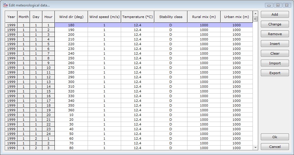
- Import meteorological data from Excel CSV files, ASCII txt files, or directly edit them in the program`s editor.
- Create contour maps.
- Create tabular reports.
- Generate customizable comprehensive printouts for some or all of your calculations.
- The new version is fully compatible with all EPA models and Breeze software.
- Customizable pollution contours that can be exported to DXF files.
- Enhanced Microsoft Word reports.
- Multilevel undo and redo.
- Compatible with all former versions of the program.
- Professional reports and printouts.
- Tip of the day.
- Full user guide.
- Tutorials.
- Live Update.
- English and Greek interface.